The First Atlas Illustrated with Woodcut Maps


The First Atlas Illustrated with Woodcut Maps
By PTOLEMAEUS, Claudius; translated by ANGELUS, Jacobus, and edited by Nicolaus GERMANUS., 1482
Price: £985,000
YOUR PURCHASE WILL EARN A LUXCASHBACK REWARD
YOUR PURCHASE WILL SUPPORT GOOD CAUSES VIA LUXGIVEBACK
Description
Author: PTOLEMAEUS, Claudius; translated by ANGELUS, Jacobus, and edited by Nicolaus GERMANUS.
Publication place: Ulm
Publisher: Lienhart Holle
Publication date: 16 July 1482.
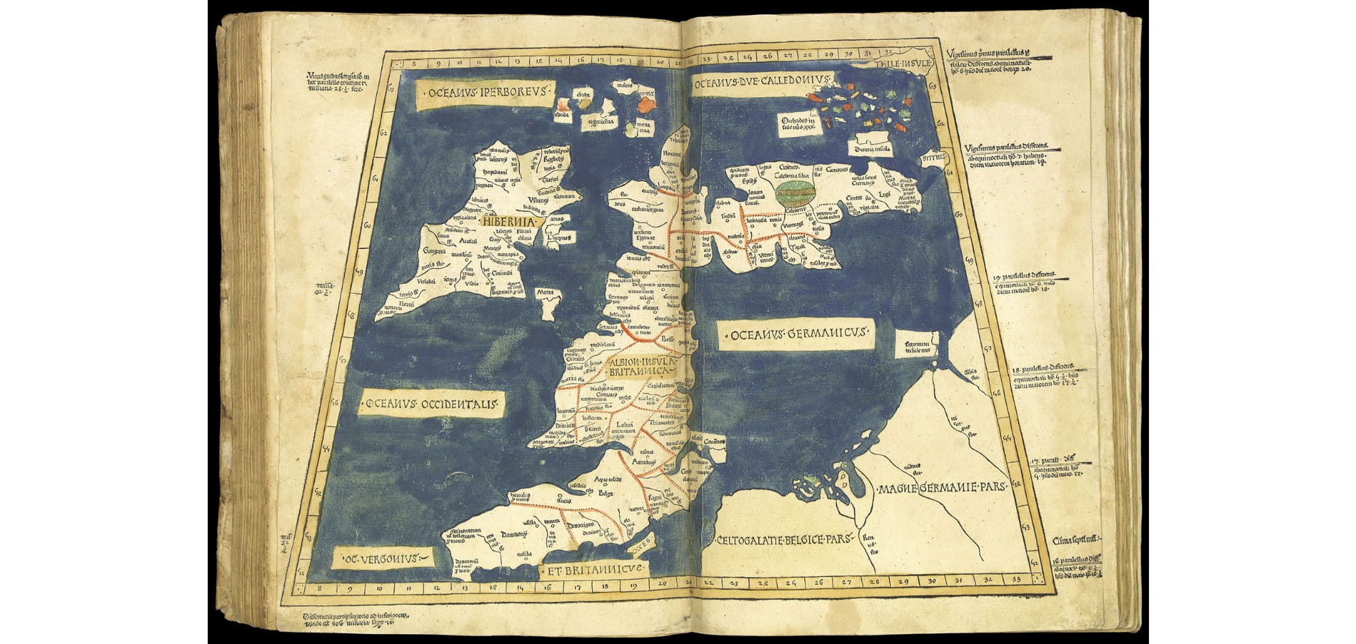
Physical description: Royal folio atlas. 140 leaves, double-column, 44 lines and headline, Gothic letter, 32 woodcut maps (all but one double-page, the map of the caucuses supplied from another example of the atlas), with FINE CONTEMPORARY HAND-COLOUR, 4 woodcut diagrams in the text, 2 large historiated initials, one showing Donnus Nicolaus presenting his book to Pope Paul II, the other of Ptolemy, 159 other woodcut initials coloured in red, green and ochre, paragraph marks and initial-strokes supplied in ochre, limp vellum, with numerous annotations in pen and ink to upper lower cover, slightly soiled. Collation: A‑E(8); a‑i(8); 32 maps; a‑c(8)
Dimensions: 414 by 297mm. (16.25 by 11.75 inches).
Inventory reference: 1433
Provenance
early inscription of Adrian de Plante surrounding a 6‑pointed star on the back cover; inscribed on the front free endpaper “Donnait Le Sr. munery mon beaufrere anno 1672 Morel Senator”; further inscribed on dii “Josephus Mattheus de Morel 1718, Franciseii de Morel”; and with pen trials dated 1717 and 1728 by various Morels on the endpapers.